The geologic time scale provides a system of chronologic measurement relating stratigraphy to time that is used by geologists, paleontologists and other earth scientists to describe the timing and relationships between events that have occurred during the history of the Earth. The table of geologic time spans presented here agrees with the dates and nomenclature proposed by the International Commission on Stratigraphy, and uses the standard color codes of the United States Geological Survey.
Evidence from radiometric dating indicates that the Earth is about 4.570 billion years old. The geological or deep time of Earth's past has been organized into various units according to events which took place in each period. Different spans of time on the time scale are usually delimited by major geological or paleontological events, such as mass extinctions. For example, the boundary between the Cretaceous period and the Paleogene period is defined by the Cretaceous–Tertiary extinction event, which marked the demise of the dinosaurs and of many marine species. Older periods which predate the reliable fossil record are defined by absolute age.
Geologic time scale - Wikipedia, the free encyclopedia
emphasis mine, -jt3
Chronostratigraphy relies heavily upon isotope geology and geochronology to derive hard dating of known and well defined rock units which contain the specific fossil assemblages defined by the stratigraphic system. However, it is practically very difficult to isotopically date most fossils and sedimentary rocks directly, and thus inferences must be made in order to arrive at an age date which reflects the beginning of the interval.
The methodology used is derived from the law of superposition and the principles of cross-cutting relationships.
Because igneous rocks occur at specific intervals in time and are essentially instantaneous on a geologic time scale, and because they contain mineral assemblages which may be dated more accurately and precisely by isotopic methods, the construction of a chronostratigraphic column will rely heavily upon intrusive and extrusive igneous rocks.
Metamorphism, often associated with faulting, may also be used to bracket depositional intervals in a chronostratigraphic column. Metamorphic rocks can occasionally be dated, and this may give some limits to the age at which a bed could have been laid down. For example, if a bed containing graptolites overlies crystalline basement at some point, dating the crystalline basement will give a maximum age of that fossil assemblage.
Chronostratigraphy - Wikipedia, the free encyclopedia
emphasis mine, -jt3
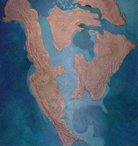
The Chinle Formation, widely exposed throughout the Colorado Plateau area, was deposited in a large basin that was filled by westward and northwestward flowing streams and lacustrine sediments (Blakey and Gubitosa, 1893). According to Smiley (1985), the Mogollon highlands, situated within central and southern Arizona, provided a source of eolian and fluvial-transported volcanic sediments, lahars and sediments from the older Permian-age formations. Within southeastern Utah, the Uncompahgre ighlands (sic) are said to have provided a further source of volcanoclastic material. However, studies by Blakey and Middleton (1983) and Middleton (pers. Comm., 1988, 1989) indicate that the source area for the volcanoclastics is not clearly established. At least some of the volcanoclastic material deposited by the Chinle streams was probably derived from the Cordilleran volcanic arc to the west and southwest of the Chinle basin, and other clasts in the Sonsela and Shinarump are most likely derived from Precambrian sources in central Arizona.
The Panthalassa shoreline was situated near the western edge of Arizona, with a number of rivers draining into it from the highland areas. The dominant depositional environments for this region consisted of fluvial and lacustrine environments deposited upon the western Pangaean floodplain (Smiley, 1985).
The tectonic and depositional situation within Arizona changed within the Upper Triassic, and especially during the Triassic-Jurassic transition. Studies by Wilson and Stewart (1967) point to a decrease in volcanic bentonites, an increase in grain size and a sediment-color change that marks the Triassic-Jurassic boundary. Sedimentological changes also are apparent between the upper and lower Petrified Forest members, indicating changes in fluvial and lacustrine deposition and possibly as concerns tectonism and climate.
http://nmnaturalhistory.org/assets/files/Bulletins/DawnAgeDinos/dawn_4_murry.pdf
A few quick notes: This suggests a shoreline right about the Arizona/California border, which seems to me correct considering how much of the California desert through there is below sea level (Salton Sea, Death Valley). The very dividing point for the Baja peninsula is at the southern end of this as well, which is noteworthy for a couple of more things…this is the point of landfall for the San Andreas fault line which extends through the center of the state up to San Francisco…*and* this is a “volcanic Hot Spot”, a cauldron not unlike the ones feeding the big island of Hawaii and the Yellowstone hot springs in Wyoming. So possibly a/the source for some of the noted volcanism needed to petrify the trees. (BTW, there are other petrified tree sites along the central California coast, FWIW) Back to the shoreline…we just finished noting a shoreline in Texas and Old Mexico, that supposedly for that source ran all the way up to Canada (I presume Hudson Bay, with the Great Lakes as residual evidence). Yet, we still have two major anomalies to account for…the Great Salt Lake, which clearly was the bottom of some primordial ocean…and the Ocean of Kansas, of which a great deal of intriguing fossil evidence exists. Seems to me if so much land used to be underwater, then there is a great deal of what used to be land under the oceans now.
Just a passing thought, but it seems to me there are far more recognizable examples of “trees of stone” than there are of any animals in the area of the PF…so wouldn’t there be aboriginal legends of stone trees?
As I mentioned previously, in keeping with the underlying theme of this thread of how old the earth is, I would like to introduce the concept of polystrate fossils in an effort to demonstrate that our understanding of geologic layering and fossil formation may not be complete as usually stated…that is, each successive layer requires millions of years to lay down.
To start I wish to point back to the hour long lecture by Dr. Esperante about the Peruvian whales, which can be accessed on Radar’s link. I realize it is a long lecture (well, not that long for a student), but it is well worth the sit through for the consideration of the points he raises. One of which is that a whale decomposes quite rapidly…for example, the baleen would disappear within a matter of hours to maybe two days at most, and yet he found examples of fossilized
baleen in the mouths of some of these finds. So, these had to be buried quite rapidly. He explains quite well and thoroughly, comparing with modern dead whales (both washed ashore and those that sink to the sea floor), and whale carcasses apparently make food for a long list of other creatures…yet the Peruvian desert finds show almost no post-mortem predation.
Now, I am fully aware of the hesitancy of the scientific community on the whole to accept catastrophism as any explanation…but the simple fact quickly gaining credence within the community is that catastrophism really is the only viable explanation in so very many cases…this whale find really being one of them.
So I must qualify my presentation by saying that I don’t think these things were “Noah’s flood,” as such, but rather likely represent a series of various catastrophes across the history of the planet. Even looking at an event like the Mount St. Helens eruption, which is acknowledged as a blip on the screen of geologic catastrophes, nevertheless we can see some possibilities of what could happen if such an event were 5, 10, 25 or a hundred times as great. For how long science scoffed at plate tectonics, only now in the past 30 or so years coming to terms with the concept…that various geologic plates shift and grind and ride over each other during the course of millions of years…but that movement is in fits and starts, almost never is it fluid. That is why we have earthquakes.
So Dr. Esperante’s whales had to be buried rapidly…there really is no other way, the physics and the chemistry would not allow any other possibility. In order for there to be no predation, they would have to be buried
on land…in other words, the lagoon/sea/body of water they found themselves corralled into raised and drained and left them high and dry. Anoxic conditions in shallow water would not explain the condition, as predatory worms and microbes would still be active, even in an anoxic condition…but due to shallow water an anoxic state was an unrealistic consideration to begin with.
And yet, that is only one example. Hopefully that will serve as a nice lead in for polystrate fossils.
According to scientists, polystrate fossils are just fossils which were buried in a relatively short time span either by one large depositional event or by several smaller ones. Geologists see no need to invoke a global flood to explain upright fossils. This position of geologists is supported by numerous examples, which have been found at numerous locations, of upright trees completely buried within either late Holocene or historic sediments. These buried upright trees demonstrate that conventional geologic processes are capable of burying and preserving trees in an upright position such that in time, they will become fossilized.
Polystrate fossil - Wikipedia, the free encyclopedia
Emphasis mine, jt3
I agree, but then this casts doubt on the “it takes millions of years to form a geologic layer” argument that permeates the discipline, no?
Geologists have also found that some of the larger upright fossil trees found within Carboniferous coal-bearing strata show evidence of regeneration after being partially buried by sediments. In these cases, the trees were clearly alive when they were partially buried by sediments. The accumulated sediment was insufficient to kill the trees immediately because of their size. As a result, some of them developed a new set of roots from their trunks just below the new ground surface. Until they either died or were overwhelmed by the accumulating sediments, these trees would likely continue to regenerate by adding height and new roots with each increment of sediment, eventually leaving several meters of former "trunk" buried underground as sediments accumulated.[4][19]
Ibid, emphasis mine, -jt3
Perhaps, but not for millions of years. If the coal seam or mineral layer required millions of years of deposition, the tree would have
long before died and rotted to nothing before more than a few inches were fossilized. The oldest trees known, Bristlecone pines, are not much more than 5000 years old. 5000 years is a geologic hiccup, not even a road bump in the geologic table. So unless these trees lived tens of millions of years before finally succumbing to fossilization, the only viable explanation is a catastrophic event.
Here’s are links to the Joggins, Nova Scotia, Canada World Heritage Site:
Joggins Fossil Cliffs: UNESCO World Natural Heritage Site at Joggins, Nova Scotia, Canada
The Joggins Fossil Cliffs - World Heritage Site - Pictures, info and travel reports
ProtectedPlanet - Joggins Fossil Cliffs World Heritage Site
Ref:
Joggins, Nova Scotia - Wikipedia, the free encyclopedia
Over a thousand images of fossils for research through the Joggins interpretive center available here:
https://mims.ednet.ns.ca/Joggins/Gallery.aspx
OK, that's what I threw together tonight, haven't even had a chance to get into the polystrate fossils in Radar's referenced site, hopefully soon. It's late, I'm tired and I work in the morning.
Good night gents, and thank you for a stimulating conversation.